
Online mapping services expose details of US military bases targeted by Iran

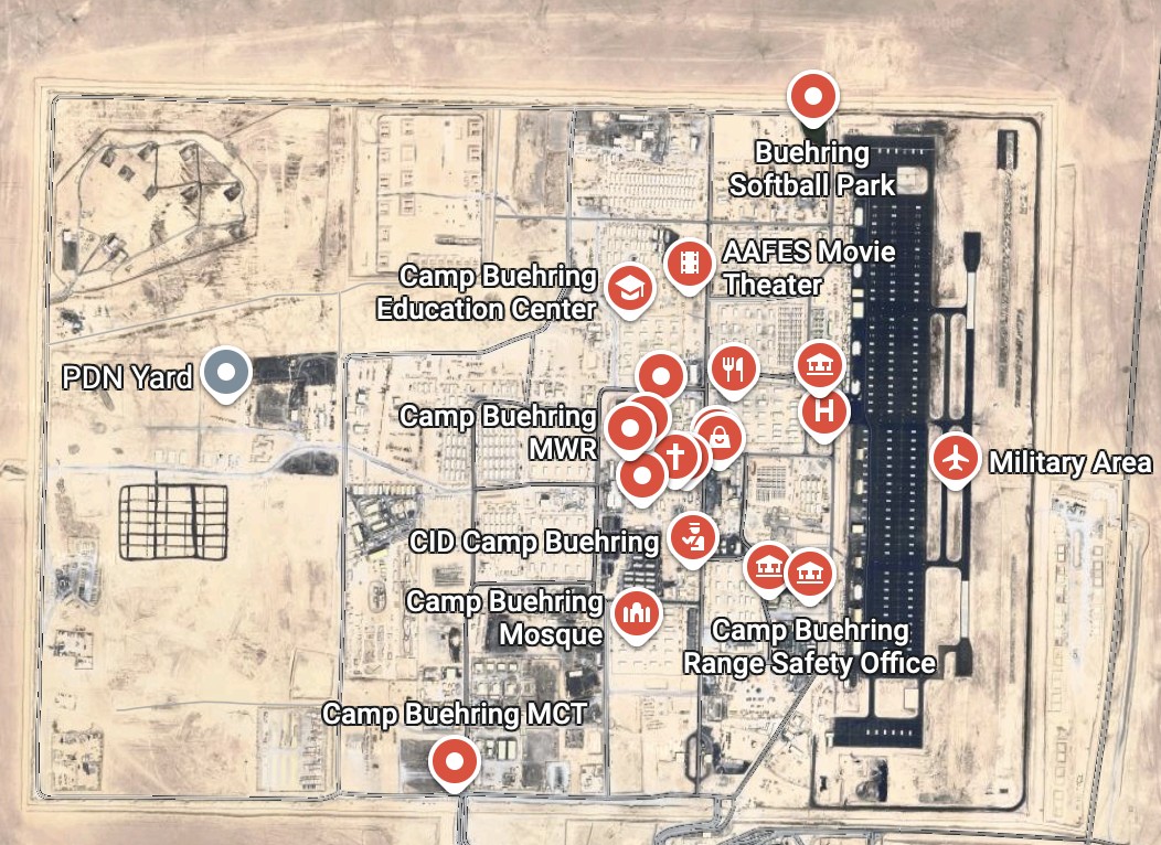
Publicly available online mapping services continue to reveal detailed layouts of US military bases targeted by Iranian strikes in the Middle East.
Commercial online mapping platforms and publicly available satellite imagery have increasingly exposed sensitive layout details of US military installations across the Middle East. An open-source investigation highlights how these accessible digital maps reveal infrastructure at facilities previously targeted by Iranian drone and missile strikes, including locations in Kuwait and Saudi Arabia. While military authorities maintain operational security measures, publicly available mapping services frequently update high-resolution imagery, allowing external actors to track base expansions, defense systems, and potential vulnerabilities. The accessibility of such detailed spatial data raises ongoing questions regarding perimeter security and information management for international force deployments in sensitive regions.
Sources: Bellingcat.