
Nepal Landslide and Flash Flood Damage Hydropower Infrastructure in Gorkha

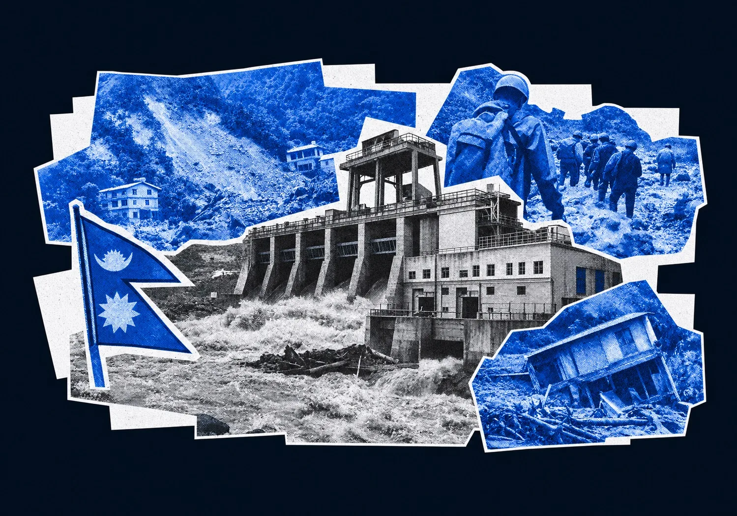
A massive landslide in Nepal’s Gorkha district has blocked the Budhi Gandaki River, triggering severe flash floods that destroyed bridges, homes, and a major hydropower project. With rescue operations underway and long-term climate risks mounting, the disaster highlights the growing vulnerability of Himalayan infrastructure.
The landslide occurred at Chumnubri, near Chumchure village, roughly 100km west of Kathmandu. Rock and soil fell into the Budhi Gandaki, creating a temporary barrier across the river. When it breached, the accumulated water rushed downstream through Gorkha and Dhading districts.
The consequences extended well beyond the immediate flood zone. Four bridges, including two motorable and two suspension bridges, were damaged or destroyed. Around 35 to 40 homes and sheds were swept away or damaged, according to initial estimates. Power and communications infrastructure along the river was also affected, while construction at a local hydropower plant suffered direct damage.

Residents along the riverbanks were urged to move to higher ground. Evacuations included settlements around Arughat, a transit town on the highway linking Kathmandu with surrounding districts. For communities dependent on a small number of roads and bridges, the loss of a crossing can mean more than a lengthy detour. It can interrupt the movement of food, medical supplies, construction materials and emergency assistance.
Nepal’s National Disaster Risk Reduction and Management Authority issued warnings as rescue operations continued. By Monday, the office of Prime Minister Balendra Shah had announced the end of the immediate search-and-rescue phase for victims of the broader regional flooding crisis, shifting the official focus towards restoring transport routes, repairing bridges and reaching cut-off mountain communities.
That change in priorities is unavoidable. It is also where Nepal’s longer-term difficulties begin.
The danger does not require a major downpour
A flood triggered by a landslide rather than extreme rainfall challenges the assumption that mountain disasters can be managed principally through weather forecasts and emergency preparations for the monsoon.
The Budhi Gandaki incident began with a dry landslide. Its destructive potential emerged when the debris obstructed the river and water accumulated behind it. Once the barrier failed, the release created a second hazard, one capable of travelling downstream and striking places that might not have been directly threatened by the original slope collapse.
Such events are particularly difficult to manage because the initial failure and the resulting flood are separate stages of the same disaster. A settlement may face little immediate danger from falling rock but still be exposed to a sudden surge caused by a blockage kilometres upstream. The time available to respond depends on whether the developing obstruction is detected before it collapses.

The Himalayan environment is becoming less forgiving. Rising temperatures have contributed to glacier retreat and the degradation of frozen material that helps bind fractured rock together. Thawing permafrost can reduce the stability of slopes, while changes in precipitation increase the amount of liquid water entering mountain terrain. The result is not simply a greater risk of flooding. It is a more complicated interaction between unstable slopes, rivers and the infrastructure occupying their paths.
Nepal’s geological history adds another layer of risk. The 2015 Gorkha earthquake fractured rock formations across the region. Damaged slopes can remain vulnerable long after the original seismic event, leaving the possibility of later failures even without an immediate trigger such as intense rainfall.
This makes disaster planning more demanding. Monitoring river levels alone is insufficient when the river can be transformed into a temporary reservoir by material falling from an unstable mountainside.
Reconstruction is becoming an economic problem
The latest damage arrives at a particularly difficult moment for Nepal’s public finances. A catastrophic disaster on August 26, 2026, along the Nepal-China border killed more than 1,400 people and left extensive damage across the affected region. The Nepali government has estimated that rebuilding after recent major disasters will cost $4.77bn, with approximately 33,000 people affected and around 7,500 homes destroyed or damaged.
Those figures describe a reconstruction challenge that extends far beyond replacing individual buildings. Roads, bridges, electricity infrastructure and communications networks must be restored together if remote communities are to resume normal economic activity. Damage to one component can prevent the others from functioning effectively.
The Budhi Gandaki flood adds to that burden. Every new round of destruction consumes resources that could otherwise support development, while interrupted transport routes make reconstruction itself more expensive. Materials and workers must reach damaged sites, and communities cut off by destroyed bridges may remain dependent on emergency assistance for longer.

For a developing country, the financial consequences can accumulate even when individual disasters are geographically limited. Funds allocated to repair existing infrastructure cannot simultaneously finance new schools, health facilities, transport links or energy capacity. Repeated emergencies also make it harder for the state to plan expenditure over several years.
There is a further risk: rebuilding the same road, bridge or settlement without accounting for the conditions that destroyed it may simply transfer the bill to the next disaster.
The $4.77bn reconstruction estimate therefore raises a question about the nature of recovery, not just its price. How much will be spent restoring what existed, and how much will be invested in making those assets safer? The available figures establish the scale of the financial challenge, but they do not show whether the reconstruction programme has sufficiently incorporated climate-resilient engineering and stricter land-use controls.
That distinction will determine whether the money buys lasting security or a temporary return to normality.
The vulnerability of Nepal’s energy ambitions
Hydropower illustrates the tension between economic development and physical exposure particularly clearly. Nepal’s river systems are central to its electricity ambitions, including exports to India and Bangladesh. Run-of-the-river projects can harness the flow of mountain rivers, but their locations also expose them to the hazards associated with steep slopes and rapidly changing water conditions.
The Budhi Gandaki project affected by Sunday’s landslide was still under construction. Damage at that stage can delay completion, increase costs and complicate the financing of a project before it begins generating electricity. More broadly, repeated losses along Himalayan river corridors threaten the reliability of the infrastructure on which future energy exports depend.
Floodwater is only part of the problem. Landslides can carry large volumes of rock and sediment into rivers, damaging structures and changing the conditions in which water infrastructure operates. A natural dam can form upstream, while a subsequent breach sends a concentrated surge downstream. Several assets may therefore be exposed to the same chain of events.
For developers and investors, the concern is not limited to the probability of a flood at a particular site. It is whether the surrounding river basin can produce cascading failures that defeat protections designed for a single hazard. Repeated damage can increase insurance costs, delay commercial operations and make expected returns less certain.
Nepal faces a difficult choice. Hydropower can support domestic electricity supply and generate export revenue, yet the infrastructure required to realise those benefits must survive increasingly complex geological risks. Expanding capacity without accounting for the stability of entire river corridors could leave the country with expensive assets that are vulnerable to the same events they are intended to help finance recovery from.
From emergency warnings to regional monitoring
The limitations of a purely reactive approach are becoming harder to ignore. Evacuation alerts and helicopter rescues remain essential, but they cannot prevent a landslide from blocking a river in the first place. Nor can they guarantee that a temporary dam will be detected early enough to protect settlements downstream.
Satellite observation and systematic slope monitoring offer a way to identify some of the warning signs before a failure occurs. Changes in terrain, glacier movement and slope stability can be monitored over time, helping authorities identify locations that deserve closer inspection. Combined with river monitoring and local warning systems, such information could support decisions about evacuations, construction restrictions and the placement of critical infrastructure.
No monitoring system can predict every sudden rockslide. Satellite data must be interpreted, warnings must reach exposed communities, and authorities need the capacity to act on what they learn. A map identifying a dangerous slope has limited value if construction continues below it or if residents have no viable route to higher ground.

Regional co-operation matters because Himalayan river basins and geological hazards do not respect administrative boundaries. The €19m South Asia Disaster Risk Reduction programme, supported by the European Union, the Coalition for Disaster Resilient Infrastructure and the European Space Agency, provides a framework for co-ordinated risk reduction across seven South Asian countries.
Its significance lies in the possibility of connecting observation with decisions about where and how development should proceed. Better information could help governments identify vulnerable transport corridors, monitor unstable slopes and direct investment towards more resilient structures. It could also help international donors assess whether reconstruction projects address the risks that have already materialised.
Yet information alone cannot resolve the underlying land-use problem. Built-up areas in hazard-prone Himalayan valleys expanded by about 45% between 2016 and 2023, according to the briefing. Homes, transport links and energy projects are increasingly concentrated in terrain where rivers, landslides and debris flows can threaten the same assets simultaneously.
Stricter zoning would impose immediate costs on communities and developers, particularly where flat land is scarce. But the alternative is to continue placing infrastructure in locations where the cost of failure is borne repeatedly by local residents and the national treasury.
Nepal’s reconstruction programme now faces that test across a landscape already altered by earthquakes, warming and expanding development. The difficult decision is whether to rebuild along the existing lines of settlement and investment, or to accept that some of the places where infrastructure once seemed most practical may no longer be safe enough to support it.
Read also:
- Search operations at the China-Nepal border are suspended as an overflowing landslide lake threatens a secondary flood, leaving over 1,500 missing after a massive glacial collapse.
- Severe floods and landslides across Nepal have killed at least 24 people and knocked out roughly 1,000 MW of hydropower generation - nearly a third of the country's capacity. As major highways collapse and key transmission lines fail, a late-September monsoon crisis has laid bare the structural risks of concentrating Nepal’s energy and transport infrastructure in narrow Himalayan valleys.